AGRICULTURE DRONE SERVICES
Monitor Crops,
Manage Irrigation,
and Much More
Our agriculture drone services have helped countless farms and agricultural businesses nationwide monitor crops, manage irrigation, assist with precision agriculture, and much more. Start optimizing inputs and driving down costs today with drone solutions.
Agriculture Drone Services Support Precision Agriculture
In agriculture, growers must cut costs while maximizing the land’s economic production. Elements like weather patterns and land movement can present a major challenge, especially over hundreds or thousands of acres of land with different ecologies, assets, and environmental obstacles.
Agriculture drone services help growers apply Precision Agriculture techniques for better crop and livestock management. Drones provide farming photography and video data, covering large land areas quickly to pinpoint where actions are needed. Drones deliver real-time feedback on soil, plant, moisture, and topography to maximize yield, avoid waste, and increase the bottom line.
Farming
Aerial drone photography services help farmers stay agile in their land management responsibilities. Drone video and photos are extremely effective for scouting land and crop features quickly, leading to smarter resource decisions that cut costs and increase production.
With agriculture drone services, growers can:
Increase crop yields by monitoring multiple issues affecting plant health and growth.
Quickly find and address crop disease, infestation, or poor irrigation not seen in ground-level checks. Analysis tools such as normalized differential vegetation indexing (NDVI) help you zero in, compare, and adjust conditions to maximize yield.
Leverage topographical, thermal, and spectral mapping to monitor and assess crop health faster with more precision over large land areas.
Perform soil & field analysis to assess moisture and fertility levels, identifying irrigation and nitrogen management actions needed to reduce waste.
How DroneDeploy Ground works
|
|
|
|
|
|
|
|
|
|
|
|
|
|
|
|
|
|
|
|
|
|
01
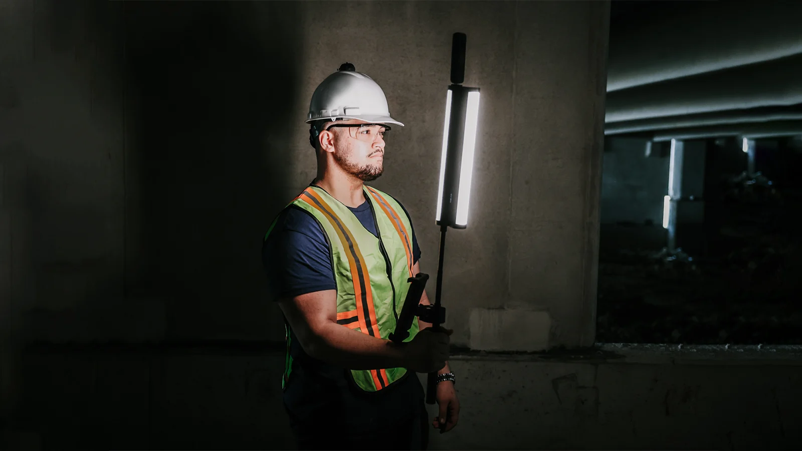
Capture:
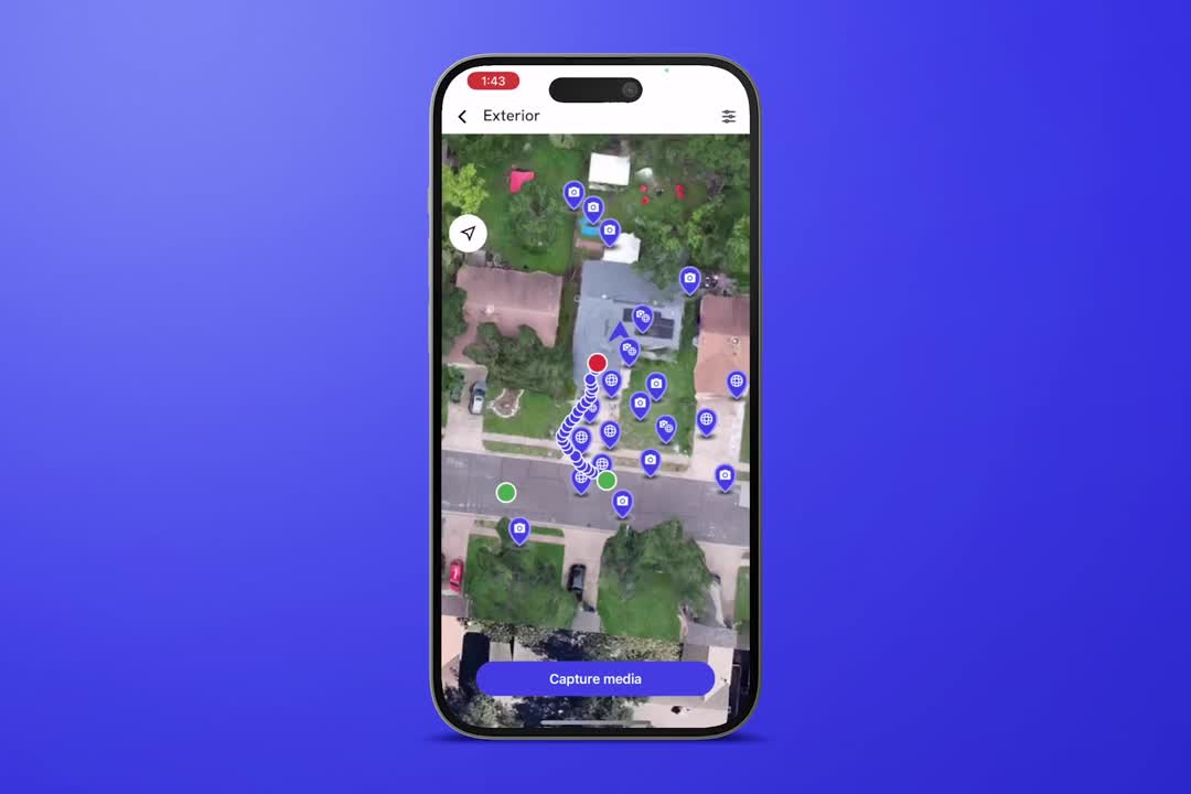
Walk your site with the DroneDeploy Ground
mobile app and a 360 camera.

|
|
|
|
|
|
|
|
|
|
|
|
|
|
|
|
|
|
|
|
|
|
02
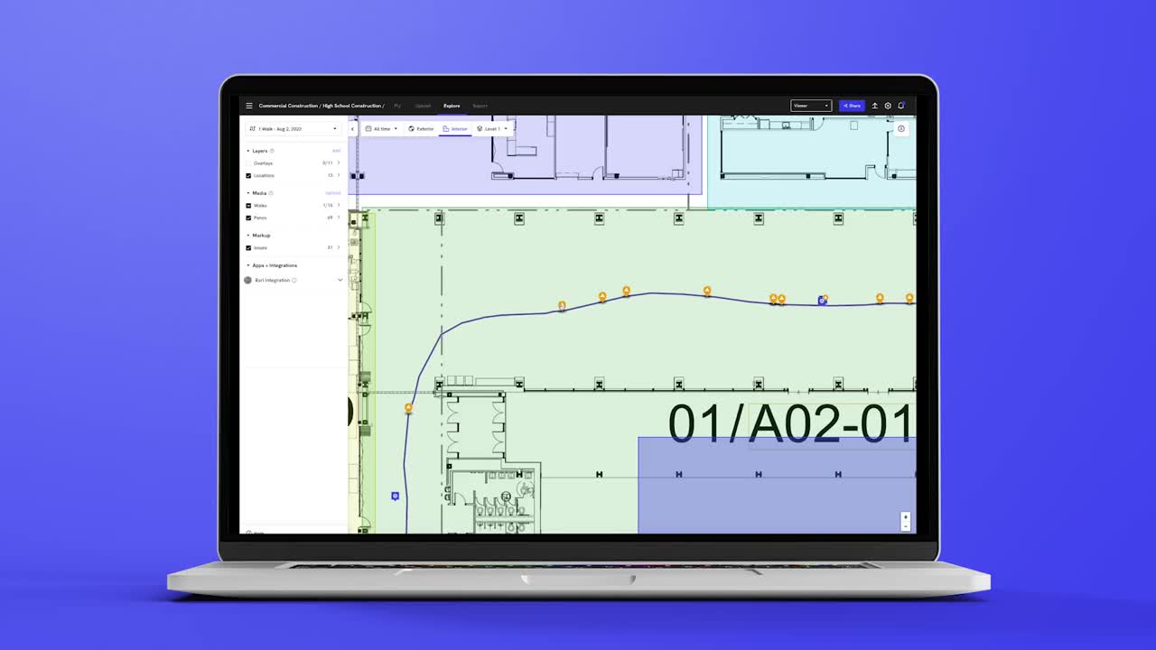
Process:
Turn interior and exterior site photos of the projects, sites and
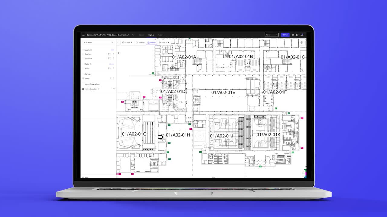
assets you care about into 360 Walks and maps.

|
|
|
|
|
|
|
|
|
|
|
|
|
|
|
|
|
|
|
|
|
|
03
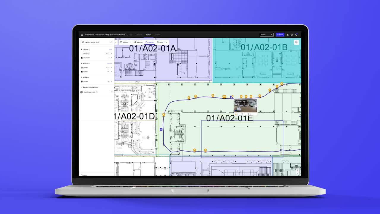
Review:
Compare what has been built to design with
BIM Compare, collaborate on drawings and floorplans,
tag issues and more.

|
|
|
|
|
|
|
|
|
|
|
|
|
|
|
|
|
|
|
|
|
|
04
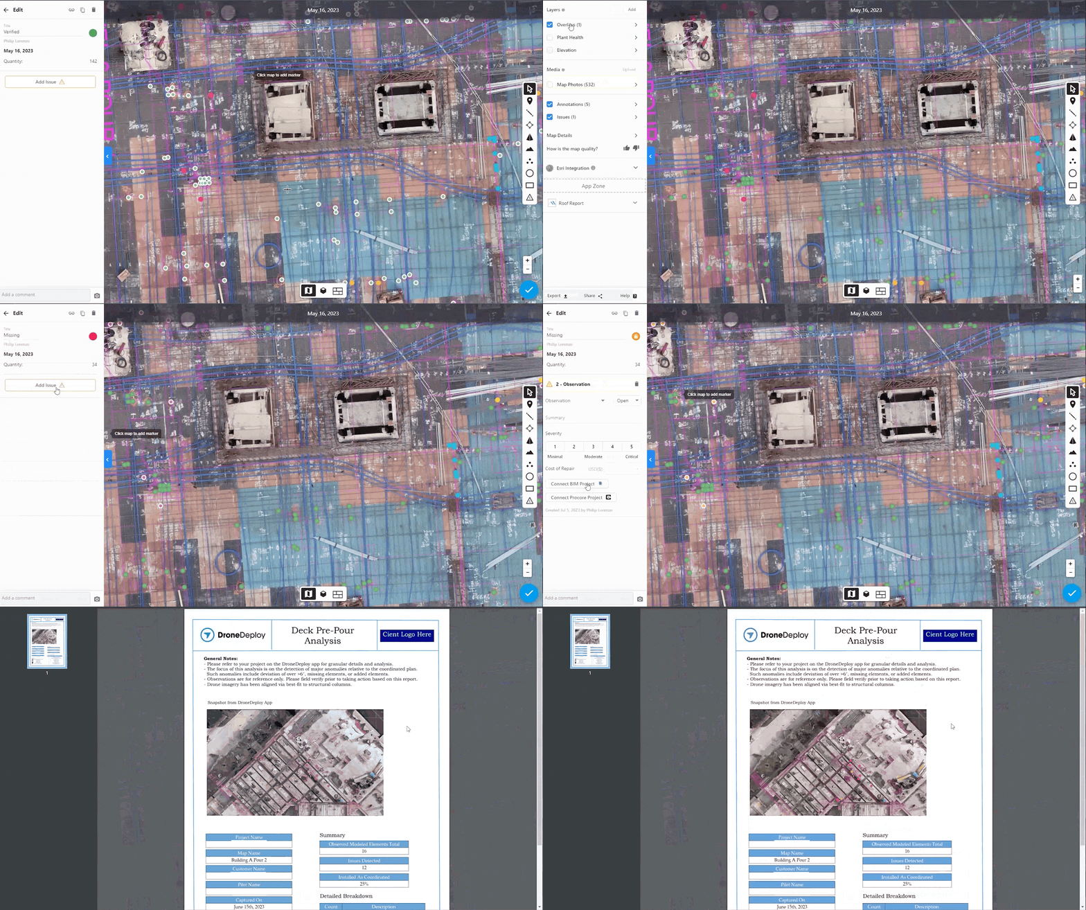
Report:
Generate detailed inspection reports from your data to
surface issues with remote teams in just a few clicks.

|
|
|
|
|
|
|
|
|
|
|
|
|
|
|
|
|
|
|
|
|
|
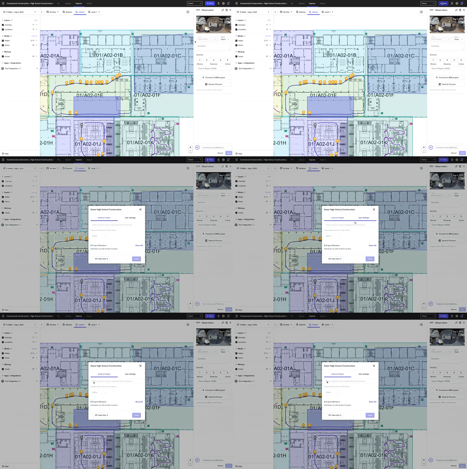
05
Share:
Collaborate with your team with instant export tools and
integrate your tech stack
with our open APIs.

We can now retroactively check our 360 Walks and identify any areas we may have missed. Then, we can directly send or tag this documentation to workers on-site through the Procore Observation tab.
Wilson Haworth
Senior VDC Engineer, Juneau Construction
We can now retroactively check our 360 Walks and identify any areas we may have missed. Then, we can directly send or tag this documentation to workers on-site through the Procore Observation tab.
Wilson Haworth
Senior VDC Engineer, Juneau Construction

SERVICES
INDUSTRIES
© 2025 Levoair. All rights reserved.
CA Resident Privacy Notice
Do Not Sell My Personal Information
Privacy Policy
Terms of Service
